
The Gehrig, Inc. team employs a wide variety of geophysical methods to answer client questions associated with exploration, engineering, and environmental projects. All geophysical methods utilize instruments to measure contrasts in the physical properties of subsurface materials. Data are processed using advanced software then the results are interpreted by our experienced geophysics staff. We can integrate geophysics with other site data into a model that will simplify the interpretation process.
Gehrig, Inc. has a high degree of flexibility regarding choice of geophysical method(s) to answer your question due to our large investment in instruments, software, computing technology, and training. This is relevant to your project because no single method can be utilized to answer every question. Our diverse toolbox allows us to select the right geophysical method, or combination of methods, to answer your specific question(s). We specialize in integrating the data from multiple geophysical methods with additional site data to leverage synergies and provide clients with a more robust, value-added deliverable.

SEISMIC
Our extensive seismic capabilities allow us to acquire 2-D and 3-D data whether your target depth is 30 feet or 10,000 feet below the surface. In-house seismic sources include a track-mounted weight drop and four Vibroseis trucks in addition to other sources for shallow studies. The Gehrig team is equipped to acquire, process, and interpret P- and S-wave reflection, refraction, MASW, downhole, and crosshole seismic data for your exploration, engineering, or environmental project.
TOWED TRANSIENT ELECTROMAGNETIC METHOD (tTEM)
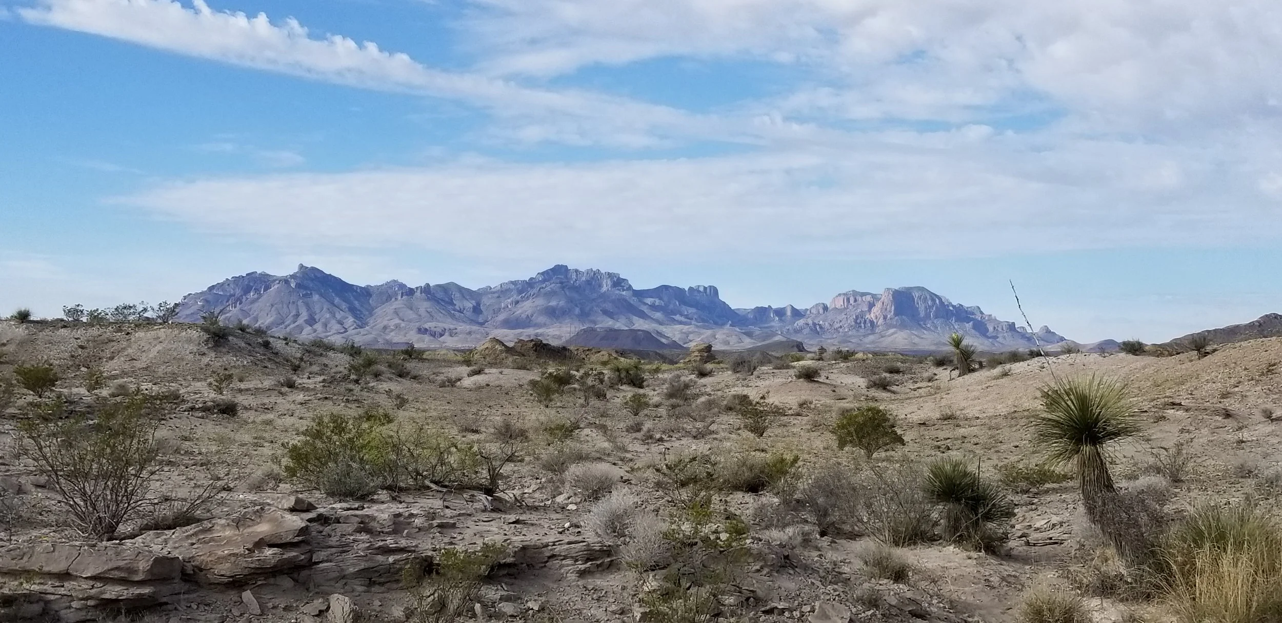
tTEM is a recently developed, revolutionary advancement in subsurface imaging technologies. tTEM is a rapid reconnaissance, 3D geo-electrical method for examining geologic layer thickness and lithology across large areas. It is a time-domain electromagnetic method that utilizes a receiver and transmitter towed behind an all-terrain vehicle to acquire densely spaced resistivity data across the area of interest. Depth of exploration for the tTEM methods is dependent on geologic conditions varying between 220 to 300+ feet below ground level. Approximately one (1) square mile per day of tTEM data can be collected.

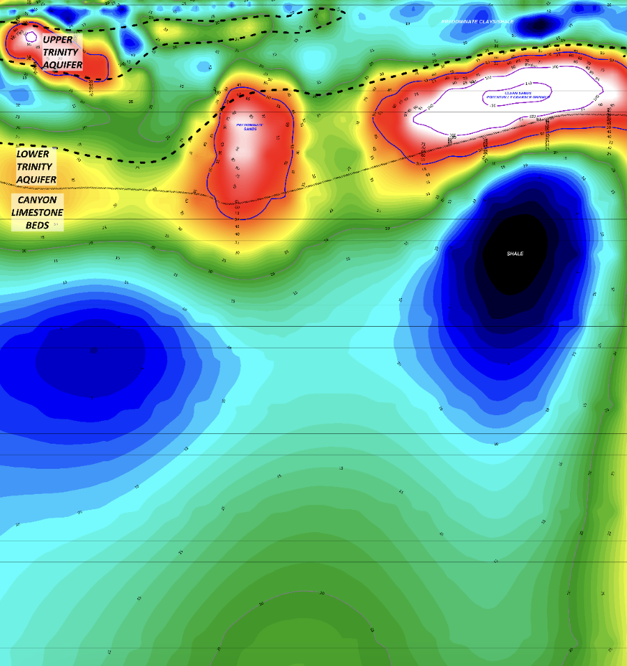
MAGNETOTELLURIC
EM3D AMT (audio magnetotelluric) is capable of deep electrical resistivity imaging to depths of approximately 3000+ feet. These technologies is typically used for deep groundwater investigations. In certain cases, a controlled source or hybrid source can be used as a signal boost during data acquisition (CSAMT or HSAMT). Data are presented as 2-D vertical and plan view profiles or 3-D features depending on acquisition design and processing.
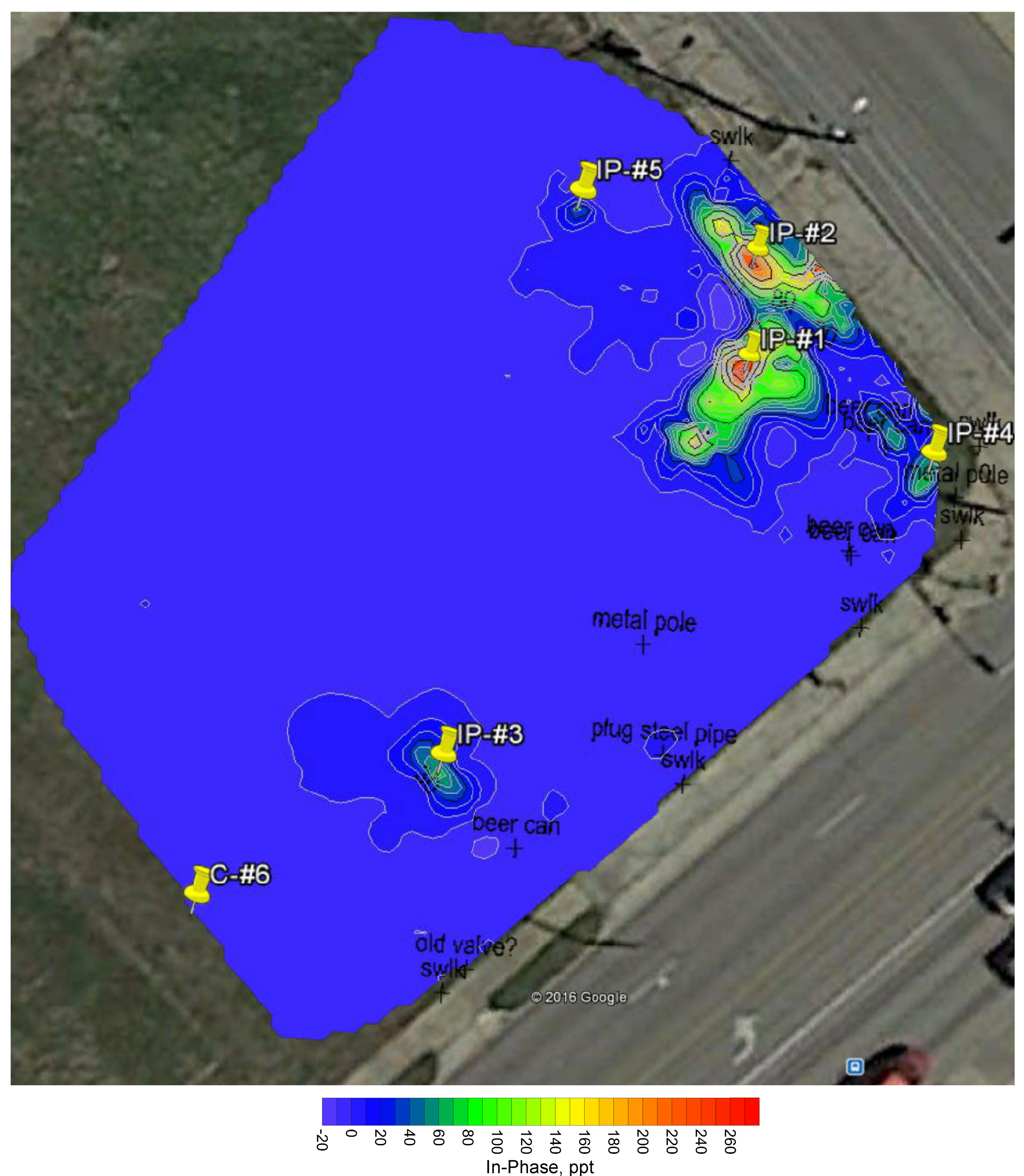
GEO-ELECTRICAL (ERT, IP & SP)
Gehrig’s geoelectrical capabilities include acquisition, processing and interpretation of 2-D, 3-D, and 4-D Electrical Resistivity Tomography, Induced Polarization, and Spontaneous Potential (ERT, IP, and SP, respectively) data depending on your project requirements. We also provide 4-pin surveys for soil resistivity investigations.


GRAVITY AND MICROGRAVITY
Our team offers gravity and microgravity investigations using our Scintrex CG-6 gravimeter to detect variations in subsurface density. This is a great method for large-scale studies to locate potential oil and gas reservoirs or micro-scale studies to delineate karst features. We commonly combine gravity surveys with other methods with the goal of providing a more robust interpretation for our clients.
ELECTROMAGNETIC (EM)
EM tools are generally used to measure vertical and lateral variations in ground conductivity and detect metallic objects. They are important for mineral exploration, site characterization, and water exploration among other uses. A variety of EM tools are available depending on your target depth and the question(s) you want answered. They offer an option for rapid data acquisition. Our multi-channel EM tool with an effective depth of about 20 feet is regularly used to acquire data for a variety of geotechnical and environmental investigations.

DRONE & GROUND MAGNETICS
Magnetometers measure contrasts in the earth’s magnetic field across an area of interest. Contrasts may be caused by variations in concentrations of naturally occurring ferrous minerals or buried ferrous metals. Magnetic methods are very robust and may be collected in a ground-based or aerial survey. Magnetic surveys are useful for locating plugged and abandoned wells.
GROUND PENETRATING RADAR (GPR)
GPR systems transmit microwave radar emissions into the subsurface. These signals are reflected at the interface of different material types. The reflected signals are received by the unit and processed to develop an image of the subsurface. GPR is useful for a wide variety of applications including general measuring pavement thickness and locating buried objects.

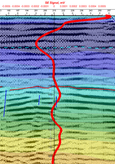
SEISMOELECTRIC (SE)
SE sounding techniques detect electrical signals generated by the passage of seismic compression waves through water-, and hydrocarbon-bearing rocks and soils. The wave front creates a subtle electrical field when passing through the target zone and this field is measured at the surface with electrodes. SE signals are then analyzed with specialized hardware and software to produce a sounding curve. Effective depths for this method range from 10 feet to 6,000 feet. SE is a powerful method to help prevent dry holes and maximize your return on drilling investment.
BOREHOLE/WIRELINE LOGGING
We utilize a full suite of Mt. Sopris wireline logging tools for logging both open and cased holes. In addition to the typical groundwater suite, we offer optical and acoustic televiewer logging as well as slimhole Nuclear Magnetic Resonance (NMR) logging. Our team meets your engineering, environmental and water well borehole logging needs with a self contained logging truck that has the capability to print onsite color well logs.


LiDAR
Our drone-based LiDAR service revolutionizes traditional survey methods by utilizing the latest technology to capture terrain data. By emitting laser pulses and measuring their return times, LiDAR generates highly accurate 3D models of the landscape in a fraction of the time. Our service produces near survey-grade Contour Maps, Digital Elevation Models, and 3D Models to provide essential information for land development, infrastructure projects, and environmental assessments.
THERMAL RESISTIVITY
Gehrig, Inc. performs both in-situ and laboratory thermal resistivity testing of soil and backfill material per ASTM D5334.